Map Library
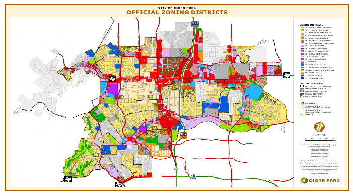
Official Zoning Districts
Zoning is a tool of land-use planning used by the City of Cedar Park. The practice of zoning allows for designating permitted uses of land based on mapped zones which separate one set of land use from another. The Official Zoning Map is a living document that changes to reflect the growth and vitality of Cedar Park.
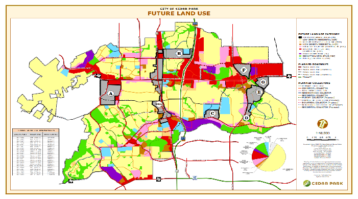
Future Land Use
Cedar Park is engaged in a robust and responsible planning process that includes long range land use goals. Those goals are depicted in the Future Land Use Map.
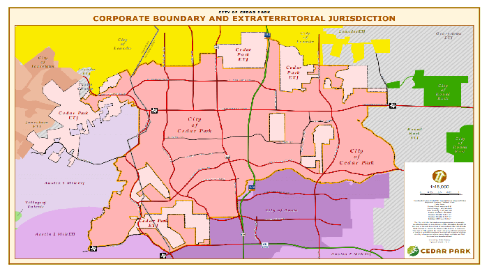
City Limits / Extraterritorial Jurisdiction (ETJ)
This map includes up to date Cedar Park corporate boundaries and current extraterritorial jurisdiction (ETJ) areas.
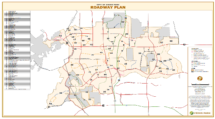
Roadway Plan
This map includes information about existing and future arterial and collector roadways in Cedar Park. The data was developed through coordinated planning efforts between the city, other municipalities, and the Capitol Area Planning Council of Governments (CAPCOG). The data is updated frequently and reflects the latest developments in the city's roadway plan.
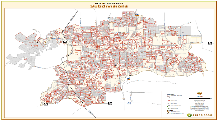
Subdivisions
All properties in Cedar Park were once part of larger undeveloped lands. A subdivision describes the process of dividing large tracts for sale or development. In some cases divided tracts are subdivided many times. This map depicts the current subdivisions in Cedar Park
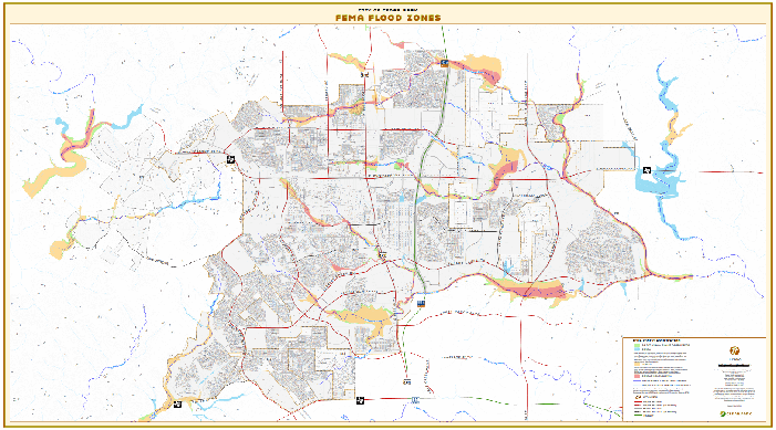
FEMA Flood Zones
Flood zones are geographic areas that the Federal Emergency Management Agency (FEMA) has defined according to varying levels of flood risk. These zones are depicted on a community's Flood Insurance Rate Map (FIRM) or Flood Hazard Boundary Map. Each zone reflects the severity or type of flooding in the area. This map depicts the flood zone areas within and directly adjacent to Cedar Park.

GPS Survey Monuments
Cedar Park GPS survey monuments are documented on individual data sheets including photographs showing their locations. All monuments are referenced to the North American Datum of 1983 (NAD83), using the High Accuracy Reference Network of 1993, (HARN). The vertical datum is referenced to the North American Vertical datum of 1988 (NAVD88) using the Geoid 99. Existing monuments, established in 1999 and 2001, are monumented with 3” brass disks set in concrete. Four more recent monuments are monumented with 3” aluminum disks set in concrete. To view detailed information about each monument including photograph and location, open the map and click on a monument, a new page will open in your browser and display the accessory information.
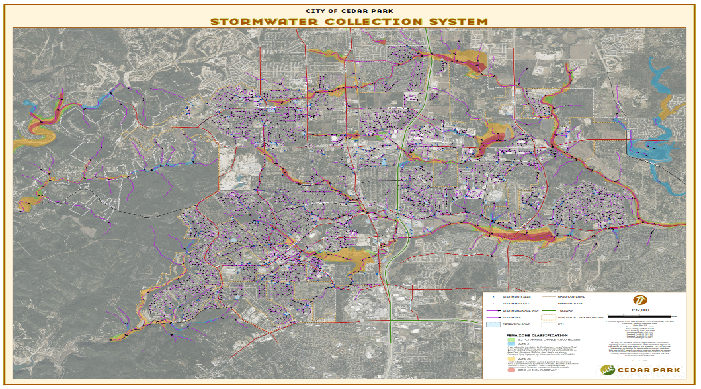
Stormwater Collection System
This map shows the current Stormwater Collection System and where the collected waters flow. It also shows the Federal Emergency Management Agency (FEMA) flood zones associated with Stormwater runoff.
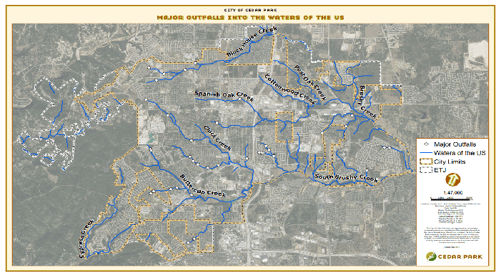
Major Outfalls into Waters of the US
This map shows all Stormwater outfalls that are classified as major and flow into “Waters of the US”. Waters of the US are determined by the National Hydrographic Dataset.